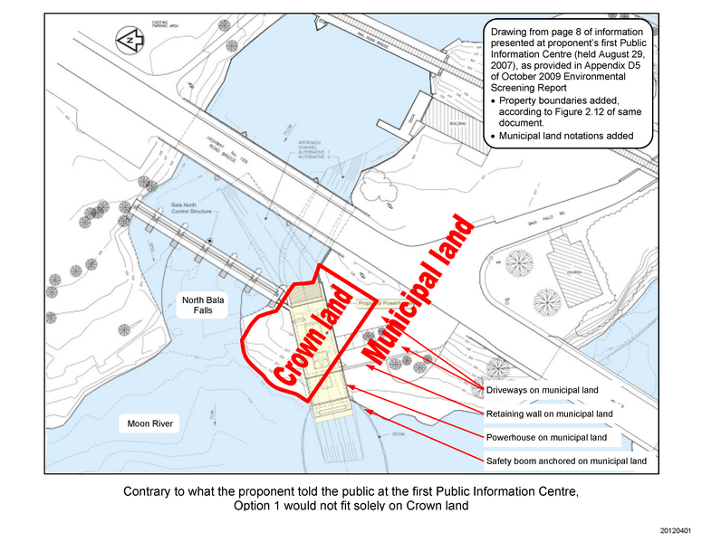
1) The proponent’s first proposal was in 2005, to the Ministry of Natural Resources. They were responding to an opportunity that would only make available the Crown land south of the Bala north falls. However, as shown in their drawing below (notations added, click on it for a larger view), their proposal actually required substantial portions of the municipal land to the south. That is, while they said their Option 1 proposal only required Crown land, clearly it needed municipal land as well.
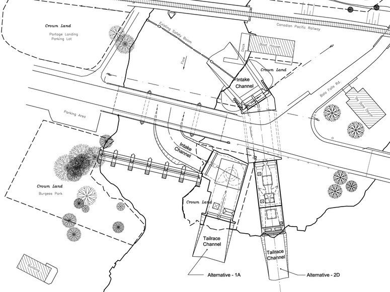
2) Beginning in 2008, the proponent proposed their Option 2 (referred to as Alternative 2D in their figure below). This required even more municipal land to the south of the Crown land, and the intake would be on the east side of Muskoka Road 169.
3) Beginning in 2012, the proponent proposed their Alternative 1A proposal, which was the first proposal that could apparently be built solely on the Crown land south of the Bala north falls. It is also the only proposal which directs the treacherously fast and turbulent water exiting the proposed tailrace closer towards the public and private docks along the north side of the Moon River.