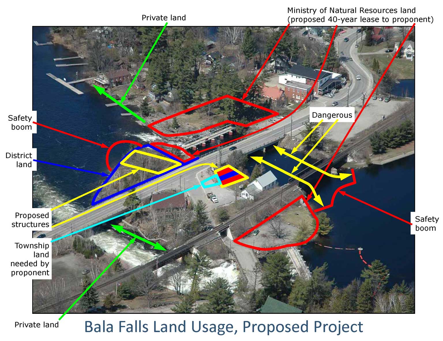
The marked-up aerial photograph above (click for a larger view) shows the:
- Land which the Ministry of Natural Resources would leave to the control – for about 40 years – of the proponent for the proposed hydro-electric generating station at the Bala Falls.
- Land which the proponent seeks to lease from the District Municipality of Muskoka so they can build their proposed power station.
- Land which the developer seeks from the Township of Muskoka Lakes, which they would also require.
As shown, this for-profit developer would therefore control virtually all the shoreline around the Bala Falls. And we only learn of this more than a year after the proponent claims to have dealt with all the environmental issues for this proposed project in their environmental screening report.
The “site release” from the MNR is for the entire area. For example, as part of this proposed project, the proponent would need to maintain and control the south dam as well. The proponent should have stated their control of, and future plans for, both Margaret Burgess Park (north of the north falls) as well as Diver’s Point (west of the south dam). The proponent’s response that “they have no plans at this time” for these lands leaves the possibility that the Township and community would end up in an expensive Ontario Municipal Board hearing to determine the fate of these lands.
The proponent should be providing written, and irrevocable, assurance that these lands would be maintained as public parks for the entire duration that any proposed generating station operates, and that the lands would not be changed, would remain freely- and publically-accessible, and that the proponent would never build, or apply to build any structures on these lands.