David Thompson was a famous surveyor and cartographer who lived from 1770 to 1857. In 1837 he was asked by the British government to find and survey a route from Lake Huron to the Ottawa River as the construction of a canal (complete with locks, so boats would not need to be portaged) was being considered.
During this exploration, Thompson kept a very detailed Journal, which is available for viewing on microfilm at the Archives of Ontario in Toronto. Some transcript and explanation of when he travelled through what is now called Bala is on pages 7 to 9, 18, and 19 of this letter.
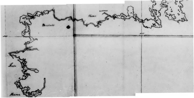
Library and Archives Canada in Ottawa has two maps he created from this trip, and these are available for viewing there on microfiche. These are reproduced below (you can click on any of the images for a larger view).
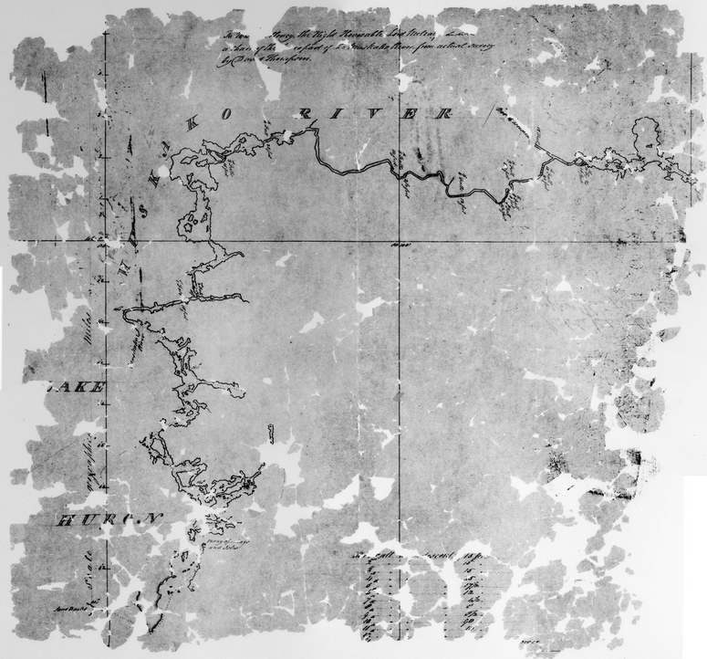
The map below is from microfiche NMC8907:
- At the top the map is entitled “To His Excellency, the Right Honorable Lord Metcalf &c &c &c a chart of the Lower part of the Muskako River, from actual survey by David Thompson.” The “&c” was the abbreviation then used for etcetera (now more commonly abbreviated “etc.”), to take the place of reciting the many titles and honours the Lord would have.
- The table at the bottom of the map summarizes the drop of each falls he encountered, referring to each falls by numbering them starting at the beginning of his expedition, with the first falls closest to Lake Huron. He then travelled by canoe upstream towards Bala and beyond.
- For lakes and wider sections of rivers he showed his exact route with a dotted line (click on any of the images to see this more clearly).
- The map shows the Muskako River (what we now call the Musquash River, which splits from the Moon River closer to Bala) from Lake Huron (we now call this part Georgian Bay) to what we now call Bala. Unfortunately, the part of the map at Bala is damaged and not readable.
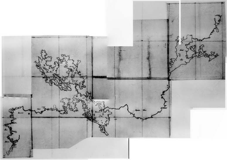
The maps below are all from Thompson’s other map of this expedition, and are from microfiches NMC119075. Library and Archives Canada has given this map the title “Map of the Muskoka River and Lake Huron to Cross Lake” (Cross Lake indeed has a “cross” shape, but is now called Oxtongue Lake).
It may be that Thompson actually made this map during the expedition, and the one above entitled to Lord Metcalf … was a copy he made for presentation to the British government (given the title and table added).
As the microfiche readers at the archives would only show a portion of this microfiche at a time (also, this map spanned two microfiches), many images recorded had to be merged, which is why this map appears to have been pieced together.
This map begins at Lake Huron at the lower-left, continues up the Musquash River, shows Bala, the three main lakes, then the Muskoka River flows through the Lake of Bays, and finally at the very top-right is Oxtongue Lake.
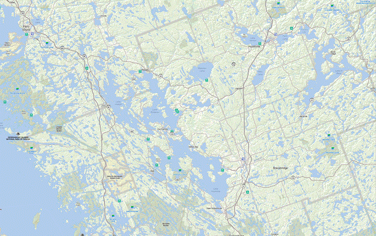
The image below shows the same geographic area as Thompson’s map, but on a current map from the Ministry of Natural Resources. This shows how fantastically accurate Thompson’s map is, though due to most of the lake water levels being increased by the many dams and other water control structures, the shorelines of most lakes will now be different.
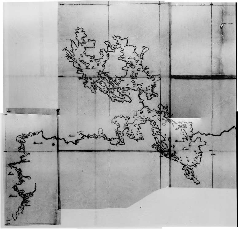
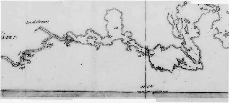
Back to Thompson’s map, here showing just the lower-left portion. If you click on it for a larger view and then use your browser to zoom in (either by clicking again, or maybe pressing “Ctrl +”), you can see:
- Lake Muskoka is labelled Muskako Lake
- Lake Rosseau is called Second Lake
- Lake Joseph is called Third Lake
The section of map below shows just the lower-left of that above, from Lake Huron to Bala Bay. What we now call the Musquash River is called the Muskako River, and where the Moon River splits off to the north he has called it North Branch. The dotted line showing his actual route can be seen by clicking on this image, and shows he travelled along the south side of Bala Bay (as the water level would have been lower then, the islands are larger), and left Bala Bay through the channel to the west of Wanilah Island.
Below is just the Bala Reach section of the above map. Thompson explored the Moon River only as far downstream as what is now the Moon Dam. Trafalgar Bay / Gaunt Bay was smaller as the water level in the Moon River would have been lower without the Moon Dam and Ragged Rapids generating station dam. What is now Ragged Rapids is shown as being the 10th Fall (he often writes the “th” directly above the number) with a drop of 90 feet. What is now the Moon Chutes is shown as being the 11th Fall, and what is now the Bala north falls is the 12th Fall, with a drop of 19 feet.
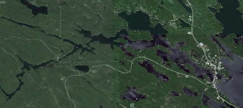
Below is the Google Earth view of the west side of the Bala Reach of the Moon River. While the shoreline is different due to the changed water levels, the orientation and scale of the map are remarkably accurate.
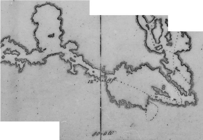
Finally, the image below zooms-in, centred on the Bala north falls (click on it for a larger view). While the Moon River was narrow enough that he did not show the dotted line of his route before he reached Bala, it is clear that when he finished portaging around the “12th Falls”, he entered Bala Bay from the south side of what is now the Bala north falls.
That is, Thompson’s map confirms the text of his Journal, that the Bala portage was on the south side of what is now the Bala north falls.
