Background
Firstly, it is clear that explorer and cartographer David Thompson was just finding existing portages, he didn’t make any. That is, the “Indians” (as he calls the people already there) had already made and continued to use all the portages needed for his travels.
Thompson’s Journal
As noted on page 8 of this letter, Thompson was travelling upstream on the Moon River and on August 13, 1837 when he first approached what is now called the Bala north falls, Thompson thought that what we now call the south channel was the portage, as he notes “the CP (carrying place – what we now call a portage) is in a bay about 80 or 100 yards to the right of the falls”.
But after he camps overnight and examines the area he realizes that the real portage is actually between Bala north falls and the south channel, as he writes “the CP close on the right of the portage is an old channel were water still runs when high”.
So we know that the Bala Portage is between what is now the Bala north falls and the south channel.
Thompson’s Map
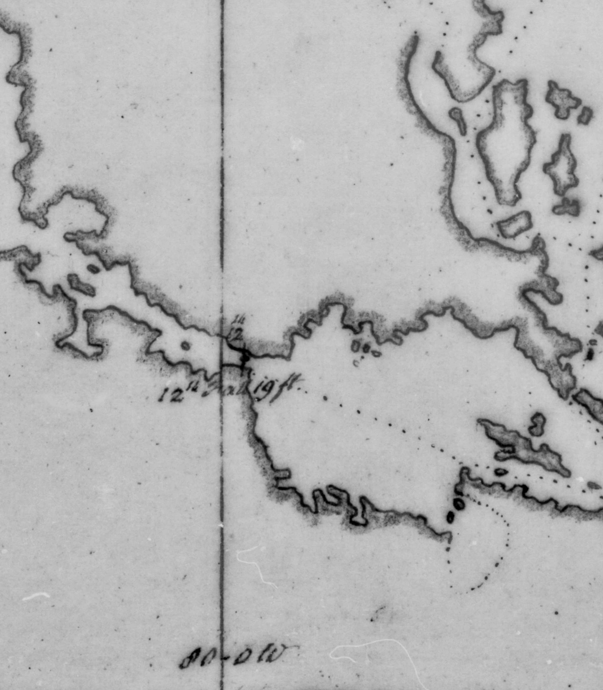
Below a section of the map Thompson created as he travelled through what is now called Bala. At the very left is Gaunt Bay / Trafalgar Bay on the Moon River, in the centre is what we now call the Bala north falls, but is here called “12th Fall, 19 ft” (as they were the twelvth falls from Georgian Bay and had a drop of 19 feet). To the right is what we now call Bala Bay (Thompson calls this Swamp Ground Lake, the earliest name for Lake Muskoka) on Lake Muskoka.
Some observations:
- The south channel was not carrying water when Thompson travelled through, so isn’t shown on the map.
- The Mill Stream / Burgess Creek also did not exist yet. Either it also only carried water during spring freshet and other times of high water in Lake Muskoka, or it was blasted by Thomas Burgess for his construction of the Bala #1 generating station (and possibly a Mill before that).
In lakes and wider rivers, Thompson shows his path with a dotted line, so Thompson’s map below confirms the Bala Portage was south of the Bala north falls. Note that all of what is now the Bala north channel would have been rapids at the time, so the upstream end of the portage was on Bala Bay (what is now called Diver’s Point).
As this area has been changed over time (major changes were the construction of the CPR railway in 1907, and the construction of the highway bypass in 1965), the exact path of the portage would have also changed – but the shortest and easiest route would have continued to be south of the Bala north falls.
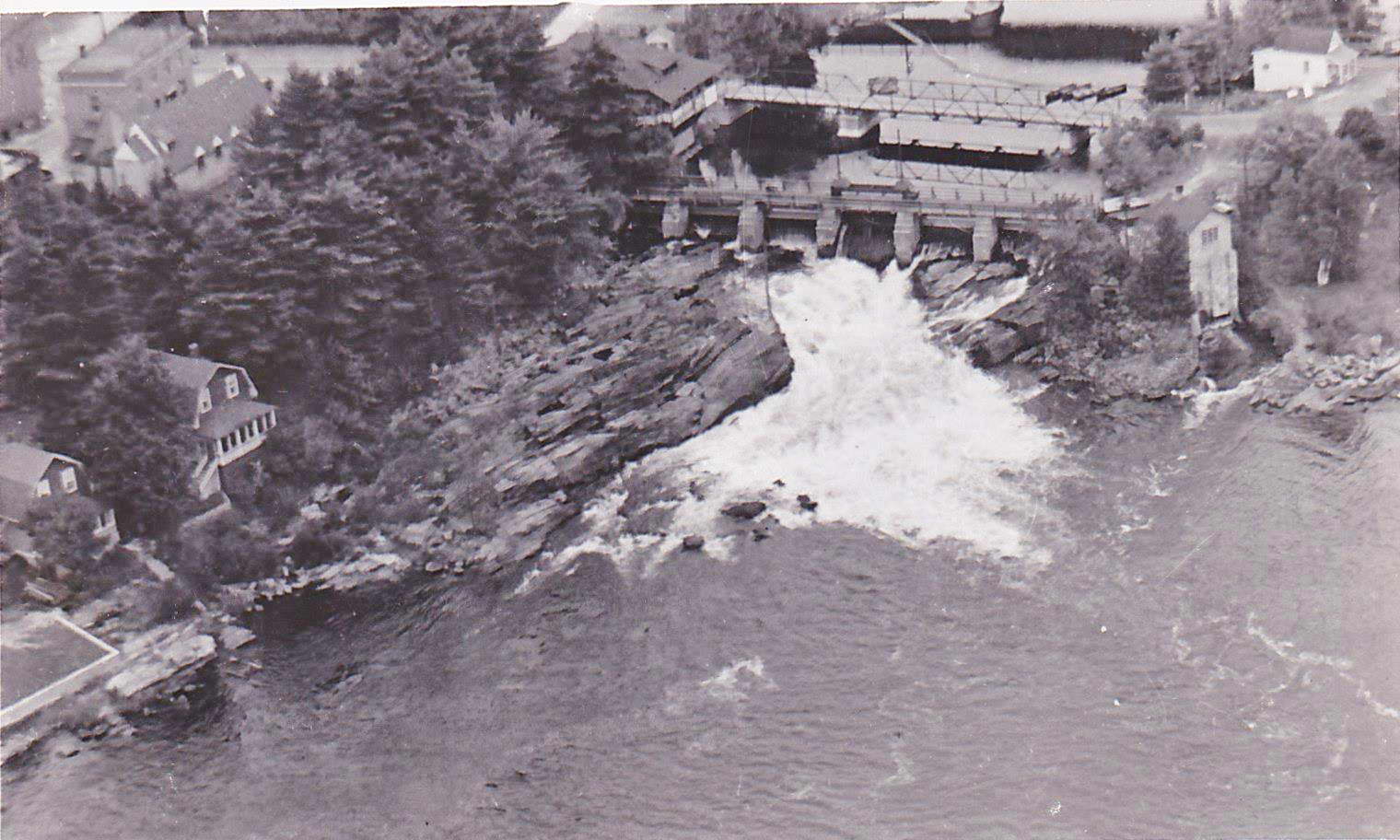
Aerial Photograph
This photograph below would have been taken between 1924 (when the Bala #2 generating station was built, or maybe later as the second story of Carr’s Arcadia has been built) and 1958 (when the Bala #2 generating station was taken out of operation). The photograph shows a path south of (that is, to the right of) the Bala #2 generating station, showing portaging would have continued south of the Bala north falls, and that there was ample room for the portage to continue to be used while the Bala #2 generating station was in operation. As the Bala north dam is now in place, so the Bala north channel is navigable, the upstream end of the portage may have often been beside Purk’s Place as that would be closer than Diver’s Point.
Current Situation
Due to the province’s construction of the highway bypass, at the Moon River end, the only path which can now be used for the Bala Portage is to pass through the highway guardrail directly south of the Muskoka Road 169 bridge over the Bala north channel. And even if there was an opening in the guardrail farther south along Muskoka Road 169, the province’s construction of the highway bypass resulted in the slope of the land up to the highway being too steep for portaging south of the guardrail opening.