In 1837, the government of Upper Canada selected explorer and cartographer David Thompson to survey a river route between Lake Huron and Ottawa to facilitate trade and the transport of goods along a route far from the border with the United States (this was only 25 years after the war of 1812, governments didn’t move any faster back then). This route would be from the Muskoka River to the Madawaska River to the Ottawa River,and Thompson was to determine the feasibility of building any required locks to raise and lower boats so they could bypass rapids, waterfalls and other non-navigable sections of river. Thompson’s maps and journal therefore included great detail, including the length and slopes of rapids and the type of rock. His notes included details of the types of trees (for logging or construction), wildlife, the weather, suitability of the land for farming − and encounters with First Nations.
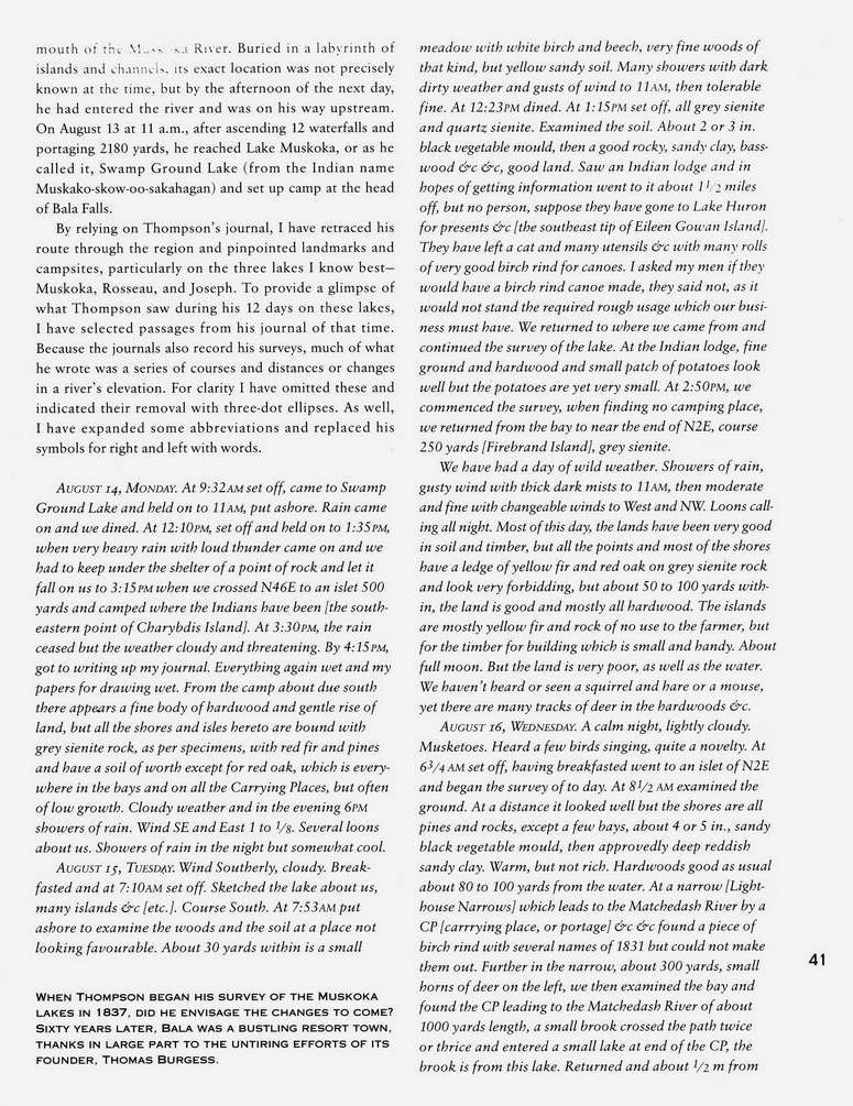
In 1994, as a commemoration of their centenary, the Muskoka Lakes Association published a magnificent hard-cover book entitled SummerTimes: In celebration of 100 years of the Muskoka Lakes Association. Local author and Thompson expert Séan Peake contributed a 14-page chapter which includes a transcription of Thompson’s journal for the 12 days he was on Lake Muskoka, Lake Joseph, and Lake Rosseau, beginning as he first sets out onto “Swamp Ground Lake” (as Lake Muskoka was then called). From the detailed distances and directions in Thompson’s journal, Peake was able to determine the current name for the locations of Thompson’s travels and observations on the lakes (these are provided in square brackets).
Some examples of Thompson’s encounters are:
- On August 14, 1837, Thompson has finished camping for the night at the Bala falls, he writes up his journal, notes that what is now the Bala south channel could be made into a lock, documents the direction, slopes and rises of what is now the Bala north falls, and at 9:32 am sets off from what is now Diver’s Point towards Lake Muskoka (more detail here). After it rains and having lunch, Thompson writes: “At 12:10 pm, set off and held on to 1:35 pm, when very heavy rain, with loud thunder came on and we had to keep under the shelter of a point of rock, and let it fall on us to 3:15 pm when we crossed N46E to an islet 500 yards and camped where the Indians have been [the south-eastern point of Charybdis Island].” That is, there was a First Nations camp on Charybdis Island (which is south of Mortimer’s Point).
- Still on Lake Muskoka, Thompson’s August 15, 1837 journal entry includes:
- “Saw an Indian lodge and in hopes of getting information went to it about 1½ miles off, but no person, suppose they have gone to Lake Huron …”. That is, it was clear to Thompson that the Bala Portage, which he had just used the previous day, was used by the First Nations, who were living on Lake Muskoka.
- “… At the Indian lodge, fine ground and hardwood and small patch of potatoes look well but the potatoes are yet very small.” That is, the First Nations lived and farmed on Lake Muskoka.
- His August 16, 1837 journal entry includes: “Held on and camped at the Indian lodge [at Eileen Gowan Island], bad campment, at 6:10 pm, the cat but no person. Many flies. Thank God we have had a very fine day and employed it well. The country appears as barren of berries as of everything else. Agriculture may do well here but nothing else will. The whole of the large islands on which we camp is mostly good land.” That is, the land is not very fertile, but there are First Nations living on Eileen Gowan Island, and they even have a cat.
In summary, it is clear the First Nations of the area lived on Lake Muskoka in 1837, and they created and used the Bala Portage.
Below is a page of Peake’s chapter in the SummerTimes book (click on it for a larger view). The book is now out of print, but used copies in excellent condition are available from Amazon.ca and other sources (ISBN 1-55046-081-1). It is most interesting to read.
